How the Franz Josef Glacier Was Formed in New Zealand
by Lina Al Quarishi, age 10
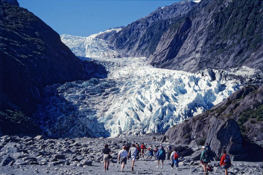
The Franz Joseph Glacier is seven miles long and located in New Zealand. The national park has alpine mountains, which are high, snowy mountains. How did this region develop into what it is today?
More than 500 million years ago, New Zealand was a part of a supercontinent known as Gondwana, which was located 35 degrees north of the equator. Over time, this supercontinent drifted south towards the South Pole. This initiated the glaciation of different parts of Gondwana and the regions that soon became Australia and New Zealand. Gondwana continued to move throughout millions of years, taking New Zealand northward to warmer zones where its ice slowly disappeared. However, some glaciers and snowy regions remained in New Zealand and were later discovered by explorers.
The Tasman Glacier took the name of the Dutch explorer Abel Tasman, who was sent on expeditions in 1642. Captain Cook, who arrived in 1769, noted the existence of the Franz Josef glacier, but a century passed until geologist Julius Von Haast explored it.
The glaciers of the southern Alps lay on the western side of the island. Mount Cook is the highest point in the region and is 3,764 meters tall. Glaciers on the western side of the mountains are short and steep and extend out to the subtropical forests. In comparison, the easter side of the mountains has higher regions that are steep and rugged and connect to central plains. Fox and Franz Josef glaciers are located on the west side of the Westland National Park – this area encompasses many alpine peaks, forests, rivers, lakes, and glaciers. Lake Mathieson is a sport that provides a great view of the three major peaks: Cook, Tasman, and La Perouse.
Despite the beauty of the glaciers and snow in New Zealand, these features are slowly disappearing due to warmer climates from global warming. It is remarkable to explore the various environments across New Zealand and understand how this region developed its unique landscapes.
[Source: 100 Great Wonders of the World]
Loading Comments...