Why the Wisconsin River Flows Backward?
by Kevin Chen, age 17
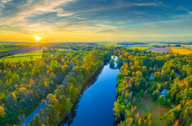
One of Wisconsin’s most familiar rivers may have once flowed in the opposite direction. According to recent geological studies, the Lower Wisconsin River might have originally flowed eastward, not westward toward the Mississippi as it does today. This surprising possibility is changing how geologists interpret the area’s geologic past and reveals how thoroughly rivers can be shaped by natural forces over time. To understand this dramatic shift, researchers have turned to focus on what lies beneath the wider Wisconsin River Valley.
There are numerous signs of a much older landscape throughout the Lower Wisconsin River Valley. A flat layer of rock at the bottom of the valley suggests that a different river once shaped this area. The unusual slope of the buried valley floor points to a flow that moves eastward. Although much of the original surface has been worn away or buried, these underground clues give researchers important insight into the river’s ancient path and larger system. However, the river didn’t change course on its own—something much larger shaped its direction.
During the Ice Age, large glaciers moved across parts of the Midwest and reshaped the land. These massive sheets of ice could block rivers, change their flow, or create entirely new channels. In this region, glaciation likely reversed a river that once moved East to the Gulf of Saint Lawrence. As ice covered and reshaped the land, drainage systems were disrupted, and new routes opened, forming parts of the modern Mississippi River Basin. Though the shift happened gradually, the effects are still visible in the landscape today. To better understand how the river valley formed, scientists needed tools that could look beneath the surface and into the past.
Scientists used LiDAR, a tool that scans the land’s surface with lasers, and core samples to see changes. LiDAR allowed them to see small elevation changes, even through forests or layers of soil. This helped reveal the shape of the buried valley, including signs that the land slopes gently to the East. Geologists also collected core samples by drilling into the ground. These samples showed a flat rock layer beneath the surface, indicating that water once moved in a different direction. However, collecting data was only part of the process, and interpreting it required a different kind of scientific thinking.
Geologists often study events that happened millions of years ago, which means they cannot run experiments the way other scientists typically do. Instead, they focus on collecting evidence—such as the shape of valleys, the tilt of buried rock layers, and patterns found in the soil—and use that information to reconstruct what likely occurred. In the case of the Lower Wisconsin River, researchers relied on present-day clues to understand how glaciation millions of years ago restructured the environment long before the Ice Age that gave us our current landscape.
The story of the Lower Wisconsin River shows that even familiar landscapes can hold surprises. What appears steady and permanent today may have once looked dramatically different. Through advanced tools, detailed fieldwork, and close analysis, researchers have found strong signs that this river once moved in the other direction. This discovery not only deepens our understanding of local geology but also reminds us that Earth’s surface is always shifting.
[Source: Wisconsin Academy of Sciences, Arts & Letters]
Loading Comments...