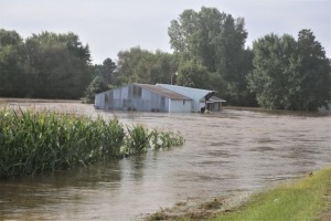
On August 20th, 2018, Madison experienced its most dramatic flooding to date as a result of a rainfall in excess of 14 inches. This not only surpassed Wisconsin’s previous one-day storm record in 1946 of 11.7 inches, but it also exceeded the National Weather Service’s “1,000-year 24-hour rainfall” estimate of 9.9 inches.
Storm runoff from Madison’s drainage area— the upper Yahara Watershed— drains into Lakes Monona and Mendota, which determine how much flooding the Isthmus and other lakefront areas endure. However, the bulk of the storm occurred 15 miles southwest of the drainage area. Had this fallen in the Yahara Watershed, the damage could have been much worse.
With this information, Dr. Bong-Chul Seo of Iowa University created an illustration with two maps that depicted the two storm events. Map one details the actual event, while map two depicts a theoretical version titled as the “Worst Case Scenario.” Map two refers to a theoretical rainstorm that would hover over the Yahara Watershed, a relatively small area, once every 1,000 years, formally known as the “1,000-year 24-hour rainfall.”
The actual storm distributed an average of 4.5 inches of rain, covering 281 square miles of the Watershed, an amount equivalent to 33,272 Olympic swimming pools. The theoretic storm would have had a rainfall of eight inches, nearly doubling the amount of storm water . Based on that information, one can presume that the “Worst Case Scenario” would cause greater destruction across Dane County.
Developed by the Hydroclimate Extremes Research Group of UW-Madison, the RainyDay Software answered an aching question for local residents: is there a possibility of a storm similar to this occurring again?
The RainyDay Software describes the relationship between rainfall depths and the likelihood of such storms recurring by using previous radar rainfall data. These are known as “intensity-duration-frequency curves.” RainyDay provides specific information regarding rainfall predictions for any given size of drainage area. Similar platforms use rain gauge observations, but these are not as helpful since they do not present a complete overview of rainfall over larger drainage areas.
Dr. Seo also created another illustration, generated by RainyDay. This graph shows the amount of rainfall in inches and a recurrence interval, which have a positive association. The storm has a recurrence period between 20 to 50 years, meaning that there is a chance of a storm, similar to the one on August 20th, occurring again.
Some researchers speculate that the effects of the storm would likely be less extreme if the rain impacted Columbia County, an agricultural area north of Dane County. Agricultural landscapes have more open fields, which absorb more rainfall than developed areas. Because the rain affected an urban location, the effects were more severe.
Dane County is exploring potential mitigation options to improve Madison’s sustainability against another major storm. The computer simulations show that the August 20th storm was not an unprecedented event. In fact, Madison must anticipate storms like this in the coming years.